Kon-Tiki2 expedition tossed about in stormy seas; expedition ended
Kon-Tiki2-rafts were delayed by headwinds far out in the Pacific, and in the end, the expedition had to be abandoned.
KON-TIKI2: Kon-Tiki2 expedition leader Torgeir Higraff ended the expedition on 17 March, after a total of 114 days at sea, and the crew of 13 was picked up by the cargo ship “Hokuetsu Ushaka”.
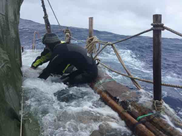
The two rafts in the Pacific struggled with relentless headwinds and counter currents. The expedition was taking much longer than expected and the crew had to start rationing food. The two balsa rafts left Easter Island on 6 January but given their delays, expected to reach Valparaiso in Chile at the end of the month, significantly later than expected.
The rafts had been expected to sail into westerly winds, which would have given them speed and wind in their journey towards their original destination in Chile. Instead they have had intense headwinds due to strong easterlies. The unexpected and unusually unstable weather has been linked with the El Niño phenomenon, which has raged during the winter.
“We have become increasingly concerned during the past week, and we support the decision to abandon the expedition,” Harald Ellingsen, head of the Department of Marine Technology, said in an NTNU press release when the decision was made to cut the expedition short.
A unique voyage
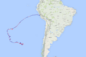
However they arrive on land, the Kon-Tiki2 voyage will be unique. No one in recent times has sailed this route with as simple a craft as the two Kon-Tiki2 rafts. The expedition first sailed from Peru to Easter Island before Christmas. That crossing, sailing in Thor Heyerdahl’s wake, took six weeks and everything went according to plan.
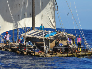
Two balsa rafts, built using centuries-old techniques, sailed from Peru to Easter Island in Thor Heyerdahl’s wake. Until 17 March, they were en route back to South America to prove that that is also possible. Photo: Kon-Tiki2
But the Kon-Tiki2 expedition wanted to prove that people in earlier times also might have sailed the opposite way and that migration could have gone in either direction. A tweet from expedition leader Torgeir Higraff at the beginning of the return voyage, however, gave an indication of how rigorous this return trip was:
“The first week of our historical effort to sail from Easter Island to South America on rafts has been very difficult in many ways. We are now further away from our goal than a week ago. To sail in the “wrong” direction many days in a row is for me like a nightmare.”
- You might also like: The Kon-Tiki2 expedition in Heyerdahl’s wake
Exploring uncharted ocean
Each raft had a crew of six or seven people. One of them was Pedro De La Torre from NTNU, who was responsible for research on board the Rahiti Tane during the return voyage. His laboratory was in the simple cabin on the deck, outside of which waves rolled over the deck.
Another important objective of the expedition was to investigate an area of the ocean that has been little studied, with the goal of providing a snapshot of the state of the ocean. This snapshot should also give researchers a sense of what is happening with the climate.
In an email to Gemini.no, De La Torre wrote that the crew had been studying “the physical, chemical and biological properties of the ocean and the atmosphere in the south-eastern Pacific. This is a stretch of ocean that has seen little shipping traffic in general, and especially little research. So it’s interesting to explore and map these waters. Among other things, we’re trying to find out whether there are man-made pollutants in these areas with limited human activity.”
What is quite certain is that the researchers found large amounts of plastic in the ocean here, both big plastic flakes that float around on the surface, and invisible microplastics that sneak into the food chain. The consequences of this last type of plastic are poorly understood, but more and more research suggests it is harmful and can even be taken up by zooplankton.
Opera software kept the expedition online more or less the whole way by compressing data volumes dramatically. The Kon-Tiki2 crew updated their website, Facebook page and Twitter account continuously.
Measuring equipment into the depths
“By taking samples and making measurements, we can build a larger and more detailed picture of what’s happening in these waters. This knowledge can then be combined with historical records to draw conclusions about the factors affecting ocean conditions, both natural and anthropogenic. We’ve already gathered information about the latest El Niño effects,” De La Torre wrote.
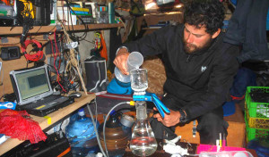
It takes a steady hand when the floor of the lab—the ocean— is in perpetual motion. Pedro De La Torre inside the lab in the cabin. Photo:Kon-Tiki2
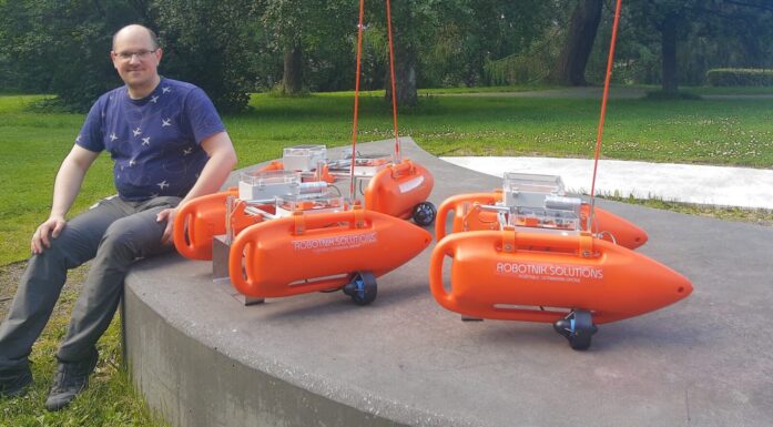
The researchers used advanced, newly developed equipment to make measurements and collect data and organic material during the journey.
De La Torre had the primary responsibility for the oceanographic and atmospheric instruments and for the collection of material. The Norwegian Institute for Water Research (NIVA) and NTNU will analyse the material collected by the expedition.
De La Torre appreciated days with calm seas. When breakers abruptly surged over the raft, the crew had more than enough to do just to navigate and make sure the equipment did not disappear into the sea. But on calm days he was able to simply lower the measuring equipment into the ocean.
Takes multiple attempts
“For each instrument we have instructions on how to meet safety conditions for acquiring data in a vessel that is floating almost level with the ocean surface,” he wrote.
“We have technical and scientific expertise on board to handle the equipment and programs, and we have ways to communicate with NIVA or NTNU for technical support when we need it,” he adds.
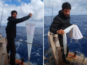
The crew took weekly samples of the levels of carbon dioxide, oxygen, turbidity (cloudiness due to small particles) and salinity in the water. They filtered out DNA and chlorophyll every fourth day with a special filter and vacuum pump. Twice a week they filtered out plankton from the water by dragging a kind of bag that collects plankton behind the raft.
“We want to better understand how non-living characteristics in the ocean and in the atmosphere, like light and temperature, affect living organisms like marine macroalgae,” De La Pedro said of the research.
- You might also like:
The next chapter in Norway’s history is to conquer the oceans
The tools of the trade
♦ A deep and a shallow CTD (device to measure conductivity, temperature, and depth): The shallow CTD is submerged to three meters below the surface, while the deep CTD is lowered approximately three kilometres down into the ocean depths. They measure the electric conductivity of water to calculate salinity, and collect information on temperature, level of light emission and turbidity.
♦ Aerosol Monitor: This instrument measures how much light from the sun is filtered in the atmosphere. This is measured by pointing the instrument directly towards the sun for one minute when the sky is clear.
♦ Deepwater Camera: Films what is in the water. The robot camera can be lowered all the way down to the ocean floor, but it is also used for filming organisms located a few meters below the raft. Some fish and other organisms are attracted to boats and occasionally follow them over long stretches of ocean. Using the video footage, scientists can determine these species.
♦ Sounder. Sends sound into the water from the hull of the raft. The sound is reflected by fish and plankton, and the signals provide information on where fish and plankton live in the water column under the raft. Over time, the measurements can provide an understanding about whether these organisms prefer certain depths at certain times of day.
Race against time
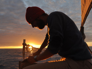
There were also moments like these on the journey. Calm sea. Completely peaceful. Sunset. Sunrise. Photo: Kon-Tiki2
If the time at sea had begun to seem long for some of the crew, at least De La Torre had a profusion of research activities to fill his time.
Polar explorer Liv Arnesen, who was part of the crew, had friends who asked her—digitally— if she was getting bored, and what she missed from life on land. She replied on her blog:
“I could mention a lot of things, but I have learned that the best to do is to enjoy what you have. Be in the moment, what people these days call «mindfulness». (…) Well, to be honest, I do miss one thing: Being totally dry!”
Expedition leader Higraff posted a message on Facebook on 8 March, 9 days before he made the decision to abort the trip:
“The next two weeks are [a] race against time. I often sit on my bed, writing or reading. Then, if I take a look at my left hand side and the wall above our laptops and iridium antenna, I see the calendar my son Sverre made for the expedition. On the sheet of March and the date 20th I get this serious reminder again and again. That date is marked with a circle. This day we must be at 90 degrees west longitude in order to keep our most pessimistic schedule and progress towards South America. Stay tuned, dear readers.”
- You might also like:How the Kon-Tiki2 rafts were built/a>
